Overview
#Mpumalanga Lowveld The Lowveld was previously known as the Eastern Transvaal Lowveld. Since the end of Apartheid in 1994 the province's name has been changed to Mpumalanga and the area in question is simply called The Lowveld.
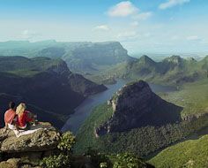
South Africa's geography mainly consists of a large interior Plato, an often mountainous escarpment and a low lying coastal plane that runs all the way up the eastern and western flanks of the country. Although the Mpumalanga border does not stretch to the ocean, the Lowveld section of the province is part of the coastal plane and is more or less 200m above sea-level. This is in contrast to nearby Belfast at 2200m, which is located on the Mpumalanga Highveld.
The Lowveld is home to very fertile fruit growing farms, the southern half of the Kruger National Park (and its private game reserve extensions) and large rural communal land areas such as Bushbuck Ridge. Tourism wise the Lowveld's biggest draw card is most definitely its wildlife. The Kruger Park's main rest camp and headquarters, Skukuza, lies within the Mpumalanga section of the Park.
The Sabie Sand Reserve consists of a collection of independent private game reserves, which has an open border with the Kruger (i.e. no fences) - thus forming part of one of the biggest wildlife areas in the world.
Tours that visit Mpumalanga Lowveld
 popular
Scheduled tours
16Day Highlights of South Africa Southbound
On this tour you journey through the most popular areas of South Africa, following the most-travelled, tried and tested route for first time visitors to the country. The tour provides a mix of cities, countryside, historical sites, scenic drives, nature, wildlife, culture and people.
from R20,910
 popular
Scheduled tours
Classic Safari Experience
On day one you travel to the renowned Kruger National Park in the Mpumalanga Province. You overnight (2 nights) at Pretoriuskop Rest Camp. Enjoy a late afternoon and full day safari in you luxury safari cruiser. On day 3 you return to Johannesburg.
from R6,950
Things to see
Town
Hazyview
##Hazyview Hazyview is a small town in Mpumalanga's Lowveld region en-route to the main gate of the Kruger National Park. Although the greater Hazyview region is beautiful and does justify the poetic name of the town, the town itself is rather drab..
3 tours visit here
Game or nature reserve
Kruger National Park
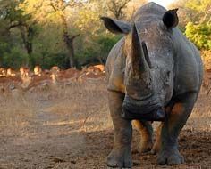
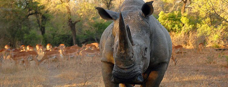
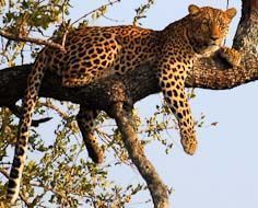
##Kruger National Park The Kruger National Park in South Africa is internationally renowned as a world leader in conservation policies, practices and techniques. This Park stretches over 20,000 square kilometers (2 million hectares) and is home to an incredible variety of plant, bird and animal species, with the “big five” included (elephant, lion, rhinoceros, leopard and buffalo).
6 tours visit here
Gallery